Wow wow wowie wow! We finished the trail!! After walking 2,660.1 miles in just a day under five months all of a sudden we found ourselves crossing the Canadian border on Monday morning. What a huge adventure and experience it has been! I remember starting the trail way back in April and Luke telling me that by the time we got to Washington it would be a “victory lap” and that we would “fly right through it.”

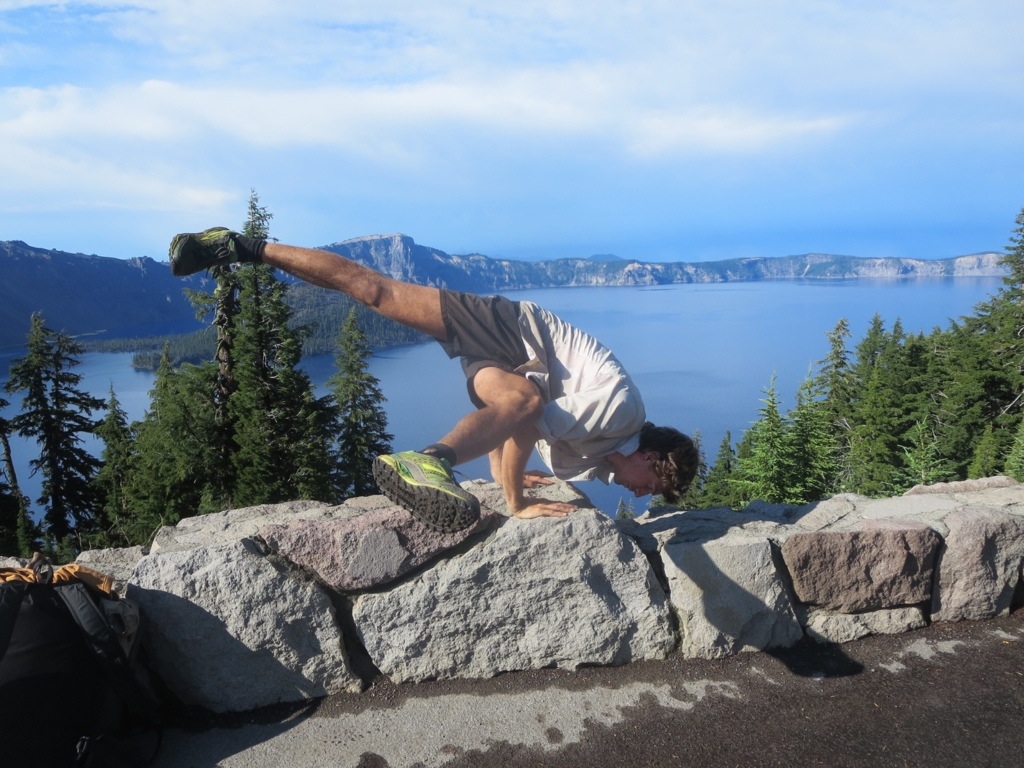
Yoga at the Monument!
It turns out, Washington was one of the most challenging sections of the trail- we faced washed out trail sections, huge downed trees, giant climbs, exposed ridge walking, tough rocky trails, frozen fingers & toes, much more rain than we were prepared for and snow! We also got to walk on top of beautiful ridges, enjoy some gloriously sunny days, look out over huge views, work our bodies hard, eat a whole bunch of extra treats to stay warm and just enjoy the heck out of the trail!
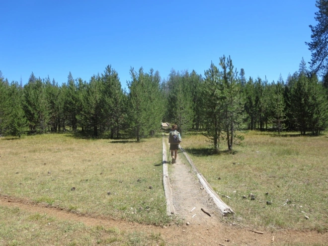
We left Skykomish/Steven’s Pass with 180 miles standing between us and the end of the trail. We had heard rumors that it would be raining for the whole 100 miles to Stehekin (our last trail town) but we left town in high spirits. We had a gorgeous sunny afternoon to hike out and had thoroughly enjoyed resting at the Dinsomore’s Hiker Haven- they were the last established trail angels on trail.

Great trail angels at a much needed rest spot!
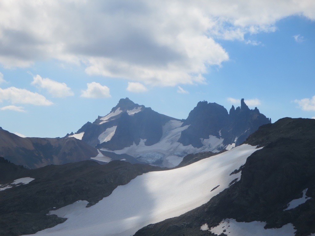
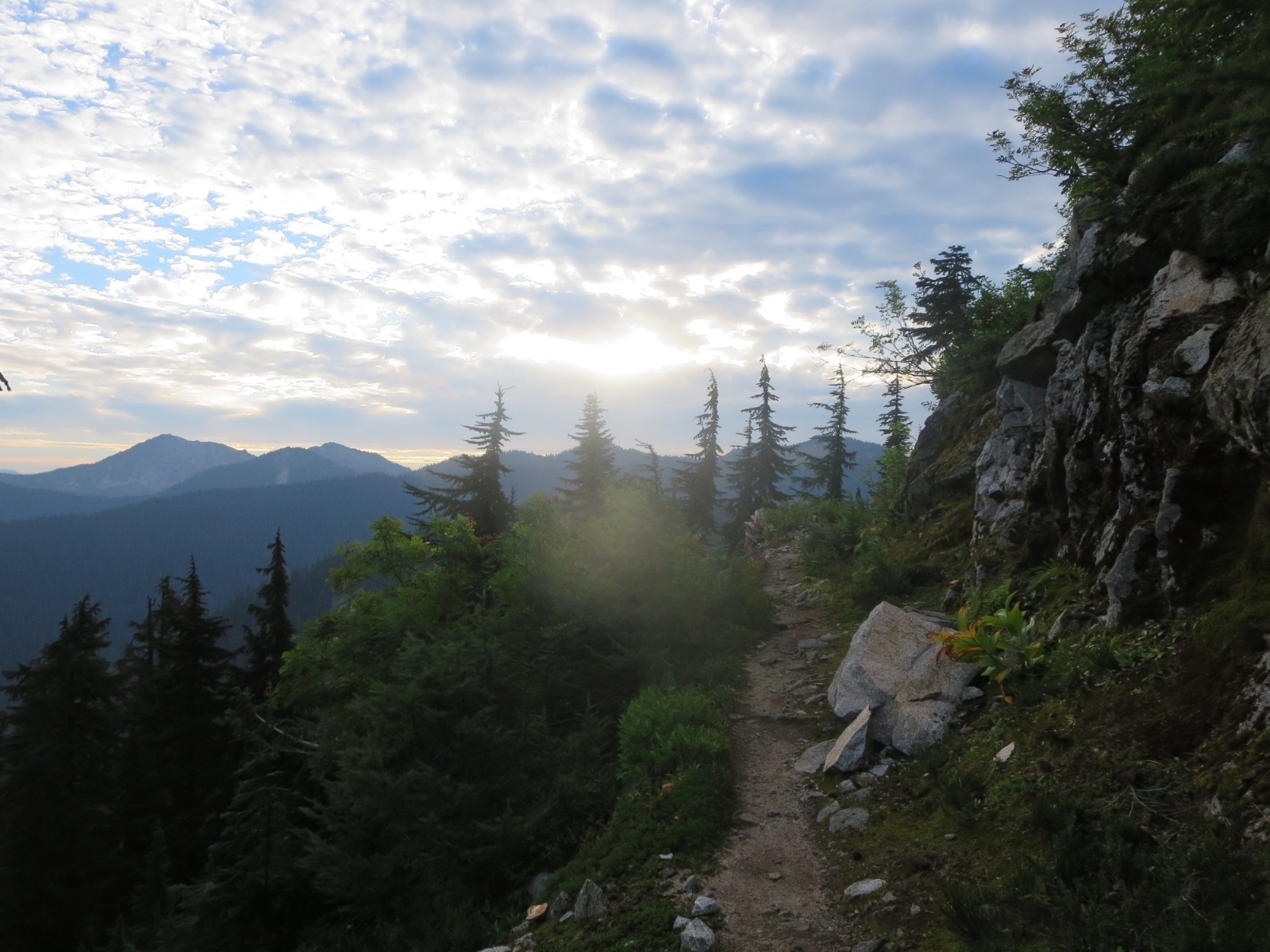
We hiked around 9 miles out that afternoon and camped at a lake with two section hikers. We woke up to an amazing sunrise with plans to do a bunch of miles to take advantage of the sunny day. We hiked into the Glacier Peak Wilderness and had our first views of Glacier Peak and the surrounding mountains. The mountains were sharp, rugged and cliffy ahead of us and we spent most of the day climbing up and down onto exposed ridges. Luckily the rain held off just about until we arrived at camp. As we hiked our last miles of the days fog and clouds began to rise up over the ridge we were walking on and down into the valley. When we arrived at camp we were surrounded in a misty foggy cloud and shortly after we finished dinner the rain began. We also ran into our friend Rabbit Stick that night and he gave us a HUGE bag of huckleberries that we ate by the spoonful!

Sunrise
Almost at our breakfast spot for the day!

Glacier Peak

PCT

One of the many mountain lakes

Views and sunshine make for happy hikers!

Another pristine lake

Clouds starting to build

And the fog starts to come in…

Almost to camp and surrounded by the mist and fog

The next few days we were in a perpetual cloud..just like this.
The next few days we were hiking in mist that would gradually turn into rain and then back to mist and clouds. We also had quite a few large and icy riving crossings to do. One of the themes of this area seemed to be bridges that were washed out, broken or made of giant blow-downs. There was also a brand new bridge built that added 5 miles to the trail- but we were so glad to have it there! This section also took us through an amazing old growth tree grove where some of the trees were over 500 or 600 years old. There were also numerous trees across the trail that we would go over, under and around. I had one of my coldest mornings on the trail in this section – we started early to catch the 3pm bus from the trail to Stehekin (our last trail town). We were hiking in the icy rain and through a trail that was at times more stream than trail. My toes rapidly went numb and we hiked as fast as we could in order to stay warm and to do 22 miles before 3pm in order to make the bus. We hiked fast (and at times ran) these 22 miles and we made it to the bus to Stehekin with just 10 minutes to spare and with a rain free afternoon! We headed into Stekehin for an afternoon of rest and what turned out to be a much needed and fun zero day.

Huge washout

One of the many “bridges” we crossed

Broken bridge

The rainy weather made for a very green and lush forest to hike through.

Old growth trees

Cold morning views

Glacial river

Trees down

Watefall

Stream or trail?

North Cascades National Park!

We made it to High Bridge with 10 minutes to spare!

This river flows into Lake Chelan- a 40ish mile long lake that the “town” of Stehekin is located on.
Stehekin- According to trail legend Billy Goat- is the Best place in America. We found it hard to disagree. There really isn’t very much there, and I can’t imagine that there are more than 100 full time residents. A post office, resort, and an absolutely phenomenal bakery is really all there is. Though there is a road that runs through town, it doesn’t lead anywhere- the road runs the length of the valley, bordered on one side by high mountains and the other by the long Lake Chelan. Lake Chelan is a beautiful blue-green lake fed by glacial meltwater. In our day and a half in Stehekin, we visited the Bakery 3 times, spent two wonderful nights with friends by the lake, and soaked up some much needed sun. By the following morning, when it was time to leave, we felt ready to set out for the last 80 miles, and the few days of rain we knew were in the forecast.

Instigate soaking it all in

Kale and Whiskey in Stehekin- what else?

Left to Right-
Scrub, Instigate, Carrot (back row), Lotus, Hermes, Spark, Blur, Robin Hood, Tallywa, Samba, Jackrabbit, Rabbit Stick

Hiker boxes in Stehekin, the last trail town
Leaving Stehekin the trail follows valleys up to 6000 and 7000 feet, where it stays virtually until the end. The first day out we had great weather, and could really feel the cool fall air. Of the seasonal foliage that there was in the mostly evergreen forests, much was changing in to its fall colors. A great group of people hiked out of Stehekin at the same time as us, and everyone from this group finished the same day as us. Our first night out it rained overnight, and we had a few showers the next morning, but the rain unexpectedly held off for most of the first day, giving one last great day of hiking. Of course, this pattern did not hold, and by the following morning, until after we finished, there was some form of precipitation coming down from the sky. Our second day out of Stehekin we got some amazing trail magic at Harts Pass, just 30 miles from the Canadian Border. We had hiked 27 miles to get there knowing that in case it was pouring we could always sleep in the pit toilets there- fortunately it stayed dry enough that we were warm and happy sleeping in our tent. We also managed to avoid any unexpected stays in the pit toilet bathrooms- some hikers weren’t quite as lucky though. Serpent Slayer and Slick B. proved to be an amazing trail angel duo, and they kept the fire, food and music going until hiker midnight- these days sometime around 9:00 PM.The next morning , fueled by pancakes and hot coffee we headed out in to another day of rain, but the knowledge that it was our last full day kept us going strong and happy! Recent washouts the size of swimming pools slowed us slightly, but they weren’t quite as bad as the trail rumors purported them to be- check out photos below. It began to snow on us towards the end of the day- by the following morning we woke up in 5 inches of snow! The snow made it a little bit harder to get out of the tent, but Blur and Goodall left around 7 AM and that motivated us to get up and going.

The trail in Washington is… tough

2601 miles!

Scrub on a big climb

Beautiful

Sub- Alpine Larch

Unexpected sunny weather!

Trail Magic!

Scrub soaking it all in
On our last day, after two totally surreal hours of hiking (and 5 months of hiking before it), we hit the Canadian Border. Both of us had always imagined this to be the climactic moment for the end of the trip, but on arrival, it felt a little subdued, knowing there were still 8 miles left until we got to the road. We finished with Jackrabbit, Instigate, Spark, and Scrub. Cookie, Blur, and Goodall finished an hour ahead of us, and Carrot, Robin Hood, Samba and Tallywa finished a few hours after us. The real moment when it felt like the trail ended was when-… well it was when the trail ended- it hit a road that it did not cross. We arrived at Manning Park Resort, and sat around, warming up with friends and relishing in that moment. It was blissful.

We woke up to 5 inches of snow around our tent on the last day!

Snowy Trail!

2,660.1 miles
Yoga at the Monument!

The monument

The literal end of the trail at the road…

Manning Park- no more walking

Staying warm after a five month hike.
So- what’s next? For now we are in Bellingham staying with Luke’s friend Ben and having an amazing time. Next up is Seattle and then Portland and then San Francisco. After we take a few days to rest and re-acclimate to the world we will have some post trip reflections, gear reviews and some additional photos up on the blog. Until then- thanks to everyone who has supported us throughout this hike! Family, friends, sponsors, strangers who became friends, complete strangers and others have been so nice and generous and excited to help us finish this hike- THANK YOU!